We offer a comprehensive range of remote sensing, photogrammetry and radar services that will assist your organisation in leveraging additional benefits from satellite and aerial imagery. Through classification, mosaicking, re-projections and image interpretation processes we can establish detailed information about land use and land cover.
Our techniques can open new windows into the unseen world, helping to deliver fresh insights into our physical landscape. Our vastly experienced remote sensing team are able to release the unseen data within your aerial imagery. Through a variety of techniques, incredible information can be uncovered such as the health of vegetation, the salinity of rivers and streams, to the discovery of sites ideal for mineral explorations. Whether tracking changes in land use, monitoring large areas of land or improving our understanding of the landscape, remote sensing is able to provide numerous benefits to a range of different industry sectors.
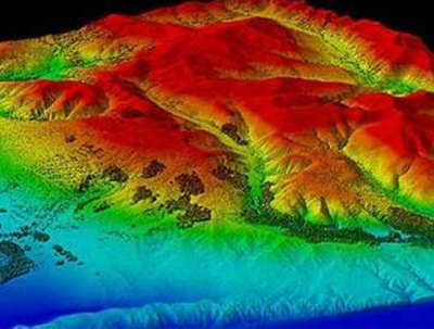
- Auto DEM Extraction
- Orthorectification
- Pansharpening
- Image Mosaicing
- Atmospheric corrections
- Color Enhancement / LUT editing
- Tiling of the Image Mosaic
- Impervious feature extraction
- GIS Database creation and Integration
- Documentation files creation
- Image Classification including Hyperspectral Remote Sensing
- Satellite imagery interpretation and classification
- Classification-supervised and unsupervised
- Change detection
- Slope aspect analysis
- Land cover classification
- Coastal ecosystem management
- Forestry mapping
- Agricultural mapping
- Mining and geology mapping
- Environmental impact assessment mapping
- Clutter data for wireless telecommunication network planning
- Watershed management
- Land cover and land cover change
- Vegetation and forest type
- Wetland extent, class, and form
- Vegetation stress and degradation
- Burned area and burn severity mapping
- Critical habitat mapping, carbon stock assessment, and high conservation value assessment
- Vegetation degradation, disturbance, and recovery monitoring
- Oil spill sensitivity mapping, pipeline corridor status, and oil spill response
- Tree cover density and canopy metrics
- Flood extent
- Coastline position monitoring
- Urban and settlement map
- Floodplain mapping and flood risk assessment
- Building inventory and footprints
- Agricultural land evaluation and status
- Linear disturbance features and vegetation recovery status
- Pipeline corridor status
- Impervious surfaces / soil sealing
- Elevation, slope, and topographic wetness index
- Hydrological network and catchment areas
- Terrain roughness