BHUBANESWAR, ODISHA +91 9437 033 041 / +91 9438 244 627 dcsbbsr@gmail.com / info@dcspl.co.in

Forest Diversion being the reuse of Land for any Utility Project is mainly the responsibility of the concerned State/Union Territory Governments. Ministry of Environment and Forests however provides financial assistance under various Central Sector and Centrally Sponsored Schemes to strengthen and upgrade the State Forest Department to prevent illegal mining and deforestation activities in forest areas.

To mitigate impacts on flora and fauna, Central Government while according approvals under the Forest (Conservation) Act, 1980 for diversion of forest land for mining stipulates appropriate conditions.

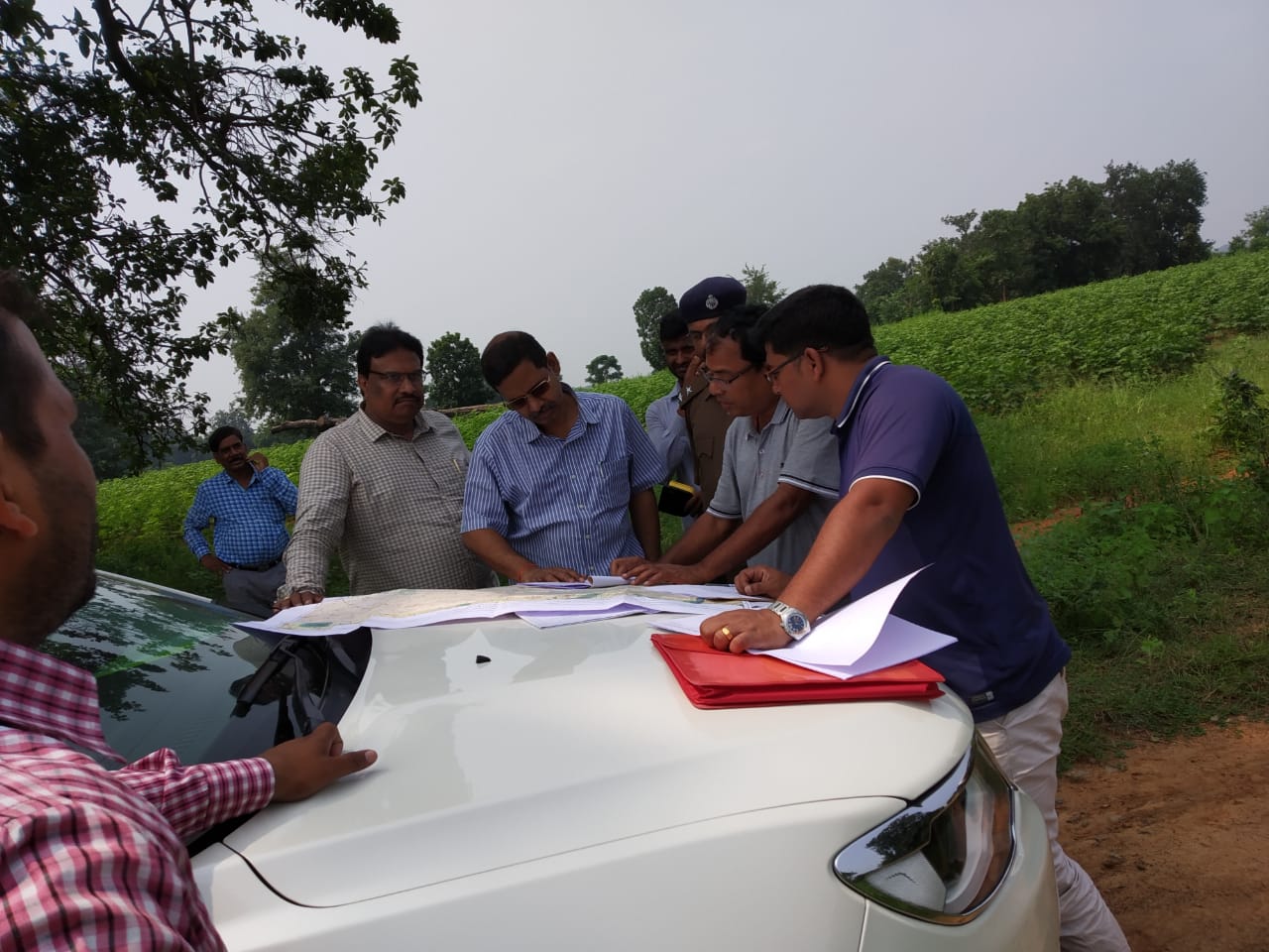
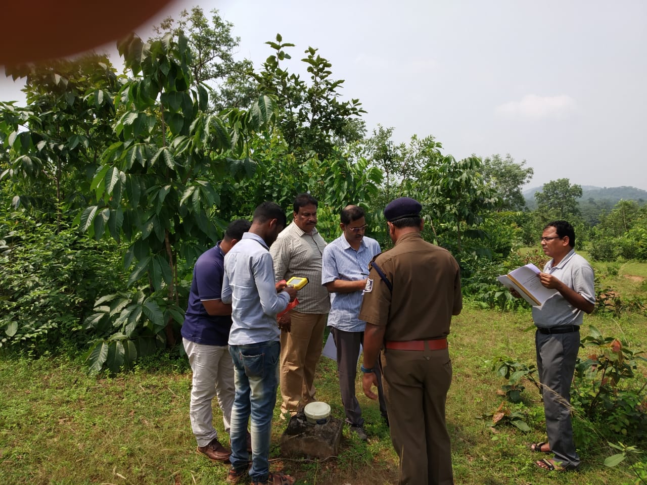
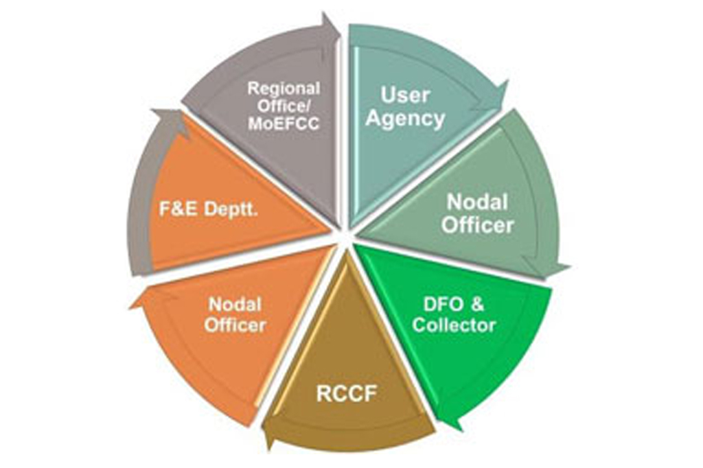
Ministry of Forest Environment and Climate Change, Government of India, has mandated online filing of applications seeking approval under Forest Clearance Act 1980. Relevant information related to the project area, forest land proposed for diversion, compensatory afforestation and other environmental mitigation measures need to be presented in a systematic manner for objective evaluation and consideration for approval.

Central Government accorded approvals under the Forest (Conservation) Act, 1980 for diversion of forest land for mining purpose since enactment of the Forest (Conservation) Act, 1980 since enactment of Forest (Conservation) Act, 1980. 

Control of illegal mining and deforestation is mainly the responsibility of the concerned State/Union Territory Governments. Ministry of Environment and Forests however provides financial assistance under various Central Sector and Centrally Sponsored Schemes to strengthen and upgrade the State Forest Department to prevent illegal mining and deforestation activities in forest areas.

To mitigate impacts on flora and fauna, Central Government while according approvals under the Forest (Conservation) Act, 1980 for diversion of forest land for mining stipulates appropriate conditions.

Important among these conditions are transfer and mutation of equivalent non-forest land in favour of State Forest Department (SFD) for creation of compensatory afforestation from the funds to be provided by the user agency; notification of such non-forest land transferred in favour of the SFD as Reserved Forest/Protected Forest; realization of Net Present Value(NPV) of the diverted forest land from the user agency for execution of various activities for conservation, protection and management of forest and wildlife and realization of funds from the user agencies for preparation and execution of appropriate plans for conservation and development of wildlife in and around the forest land diverted for non-forest purposes.

DCS has been supporting many government and corporate institutions in preparation of such forest Diversion Proposals involving compilation of relevant particulars such as maps and land schedules prepared using GIS, geo-referenced forest land preparation through DGPS surveys, DGPS and GIS based mapping of compensatory afforestation land, etc. for precise depiction of information facilitating smooth processing and timely clearance.
As per Government directives, mine lease boundaries and forest land boundaries in project area now need precise geo-referencing using Differential GPS surveys. A dedicated project team at SPARC deals with such assignments for different project specific requirements. They have handled more than 150 such assignments in the recent past.

This specialized service/ solution involves establishment of local Ground Control Points as an extension to the national/ state network of GCPs, control survey and geo-referencing of base maps (lease map), computation of precise lease/ forest boundary co-ordinates, verification/ rectification of ground demarcations, DGPS co-ordinate observation at precisely demarcated boundary points and finalization of geo-referenced maps in both GIS format and hardcopy prints. Besides, compliance to the mandated requirements, the project proponents also get to know their jurisdictions correctly, thereby avoiding boundary violations.

The GIS based geo-referencing of the forest blocks helped in

  • Preparation of precise forest boundary maps showing pillar positions with forest thematic features
  • Development of accurate forest land record for efficient forestry management
  • Platform for formulation of forest conservation/ aforestation schemes

demarcations, DGPS co-ordinate observation at precisely demarcated boundary points and finalization of geo-referenced maps in both GIS format and hardcopy prints. Besides, compliance to the mandated requirements, the project proponents also get to know their jurisdictions correctly, thereby avoiding boundary violations.

Our Clients